Geospatial analysis of wetlands based on land use/land cover dynamics using remote sensing and GIS in Sindh, Pakistan
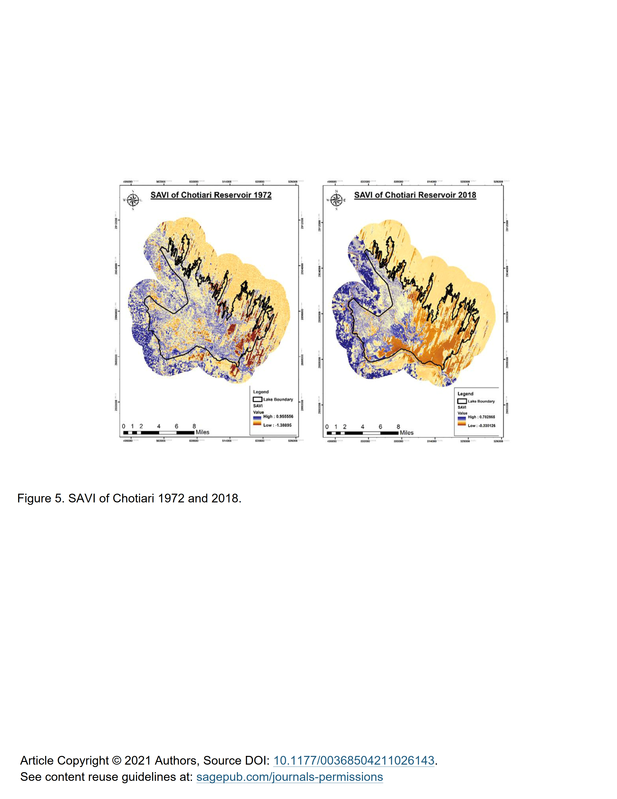
In this study, the Land Use/Land Cover (LULC) change has been observed in wetlands comprises of Manchar Lake, Keenjhar Lake, and Chotiari Reservoir in Pakistan over the last four decades from 1972 to 2020. Each wetland has been categorized into four LULC classes; water, natural vegetation, agriculture land, and dry land. Multitemporal Landsat satellite data including; Multi-Spectral Scanner (MSS), Thematic Mapper (TM), and Operational Land Imager (OLI) images were used for LULC changes evaluation. The Supervised Maximum-likelihood classifier method is used to acquire satellite imagery for detecting the LULC changes during the whole study period. Soil adjusted vegetation index technique (SAVI) was also used to reduce the effects of soil brightness values for estimating the actual vegetation cover of each study site. Results have shown the significant impact of human activities on freshwater resources by changing the natural ecosystem of wetlands. Change detection analysis showed that the impacts on the land cover affect the landscape of the study area by about 40% from 1972 to 2020. The vegetation cover of Manchar Lake and Keenjhar Lake has been decreased by 6,337.17 and 558.18 ha, respectively. SAVI analysis showed that soil profile is continuously degrading which vigorously affects vegetation cover within the study area. The overall classification accuracy and Kappa statistics showed an accuracy of >90% for all LULC mapping studies. This work demonstrates the LULC changes as a critical monitoring basis for ongoing analyses of changes in land management to enable decision-makers to establish strategies for effectively using land resources. © The Author(s) 2021.